Ribbons of Remnant Roadsides
RIBBONS OF REMNANT ROADSIDE (RRR)
RRR is a collaborative project between Murrindindi Shire Council (MSC), Upper Goulburn Landcare Network (UGLN), and Cittaslow Yea, whereby roadsides are showcased for their biodiversity and conservation significance in the landscape.
RRR was initially proposed because it was recognised that a number of our roadsides are a place of refuge for many of our local flora and fauna, but that there was little understanding in the community as to the value these remnant roadsides provide.

Wildflowers on Cathedral Lane.

Spotted Quail-thrush on Old Spring Valley Rd.
A $20,000 grant was obtained from the State Governments Threatened Species Protection Initiative programme and the project has been coordinated by the UGLN.
Round 1 of the project included Frees Rd-Gobur, Spring Valley/Old Spring Valley Loop-Flowerdale, Deviation Road-Kinglake and Cathedral Lane- Taggerty.

Brush-tailed Phascogale photographed as part of the RRR fauna survey work.
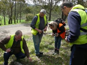
Botanical and fauna surveys, noxious and environmental weed control, revegetation and interpretive signs were organised on these roadsides and a suite of other community activities that included nest box construction & installation, wildflower walks and spotlighting.

Green Army installing nest boxes on Frees Rd.
Wildflower walk on Spring Valley Rd.
Noxious weed control was undertaken by MSC. Whilst environmental weed control was undertaken by the Green Army and Conservation Volunteers Australia and co-ordinated by UGLN.

CVA removing pine saplings.

CVA volunteers.
Understorey plants are often underrepresented on roadsides and this important structural component helps to provide our native bees, butterflies, small birds and mammals with an important food source.

NTD on Deviation Rd.

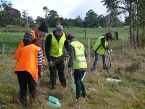
Planting along Frees Rd.
Plantings of approximately 1500 species were planted by local landcare groups as part of National Tree Day and the Green Army at all four sites.
National Tree Day participants.
New signage was installed on the roadsides indicating the endangered species known within the roadside, other flora and flora and the native vegetation communities endemic to that locality.

Signage on each road.
The project has been a fantastic collaboration between the Upper Goulburn Landcare Network, Murrindindi Shire Council and Cittaslow Yea.
Round one was so successful that round two is now being finalised and includes Old Highlands Rd-Highlands, Burns Rd-Glenburn, Kings Rd-Kinglake West and Upper King Parrot Ck Rd-Strath Ck.

Wildflower walk participants.

Koala on Frees Rd.
Chris Cobern.
Landcare Coordinator.
Upper Goulburn landcare Network.

I couldn’t get the Video on Long-nosed Bandicoot to load. Sally